How to make geospatial data accessible over API
One of the options available to you as a data publisher, is to ingest geospatial data into our system to be queryable over our Geospatial API.
Supported FormatsWe currently only allow you to ingest shapefiles into our system (see supported ingest formats).
Step 1: Create a Data Set
In order to ingest data, you will first need to create a data set. If you already have a data set you intend to use, you can skip this step, but if you have not, visit Creating a Data Set for more information.
Step 2: Upload your data
Once the data set is setup, you can then look at uploading your geospatial data to the data set.
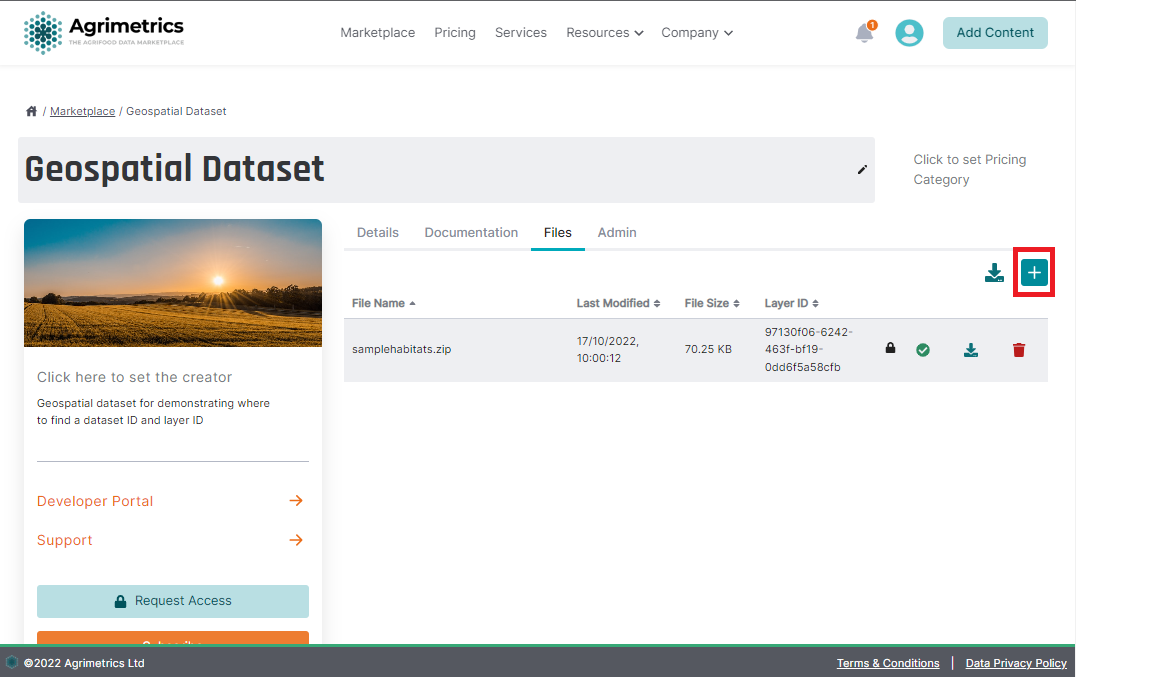
The first thing you'll need to do is upload an appropriate file. Click the "Add File" button to upload the relevant file, then wait until you can see the file in the files list.

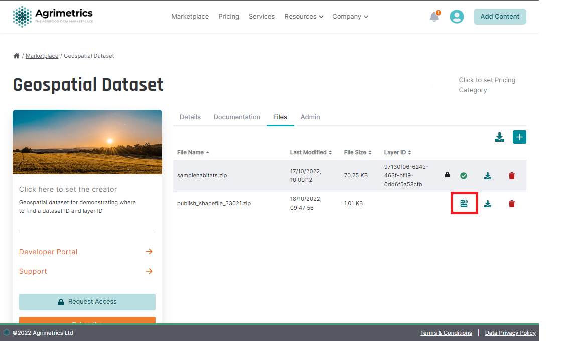
Once the file is uploaded and appearing in the files list, you should be able to ingest the contained data into our system.

If the file is of an acceptable type, you should see the ingest button. Clicking this button will start the ingest process. While the file is being ingested, you will see a loading icon. Depending on the size of the file, it could take anywhere from 1 second to several minutes for the ingest to complete.
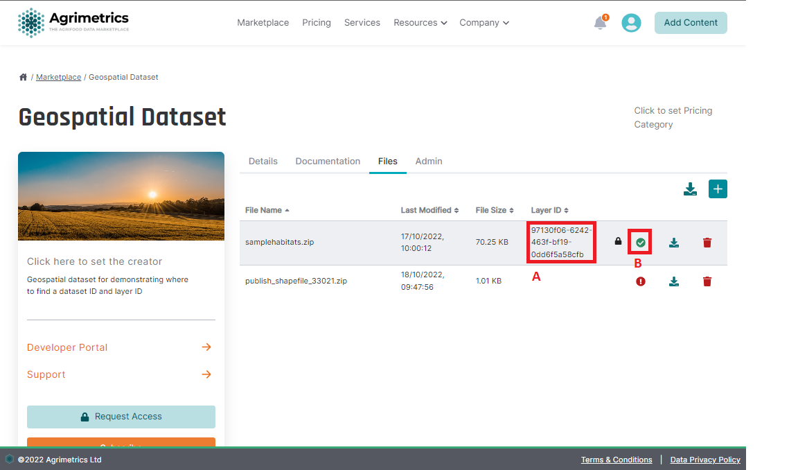
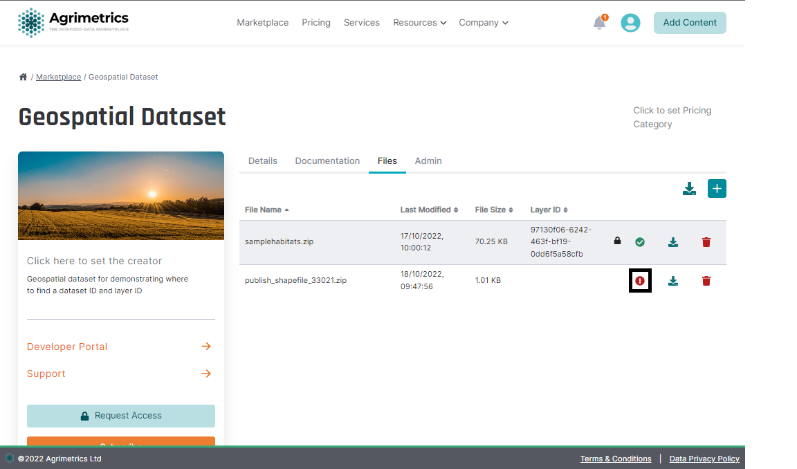
On completion, you will see one of two icons, either a green tick to indicate success, or a red error sign to indicate something went wrong.
a) Ingest Succeeded
On success, you will see confirmation that the ingest worked via a layer ID ** a **, and a green tick e y. Once you can see the layer ID, you will be able to query the layer on our Geospatial API. See Querying a geospatial layer for an example on how to query this layer.

Once a layer has been created, you may also choose to ingest additional data on to the layer. This can be done using the same process described above, and will result in the additional data being added to the existing layer on this data set.
Data CompatibilityAny additional files which you wish to ingest on a layer must match the parameters of the first layer which was ingested. Any differences (for example column names), will result in the ingest failing.
b) Ingest Failed
You may find that the ingest fails. This can be for a number of reasons, such as incompatible data, invalid file, or the file is too large to be ingested. When ingest fails, you will see an error icon. You can click this icon to see more information as to why the ingest did not succeed.

If you want to try again, you should delete the file which failed ingestion, make the necessary changes to the file, then reupload to try again.
Unhelpful Ingest ErrorsIf you find the information given in the ingest error modal doesn't clearly explain why the ingest failed, you can contact us and we'll investigate the problem in more detail.
Updated 5 months ago
